Sopwell Lane
Introduction
The photograph on this page of Sopwell Lane by Ian Capper as part of the Geograph project.
The Geograph project started in 2005 with the aim of publishing, organising and preserving representative images for every square kilometre of Great Britain, Ireland and the Isle of Man.

There are currently over 7.5m images from over 14,400 individuals and you can help contribute to the project by visiting https://www.geograph.org.uk
Sopwell Lane
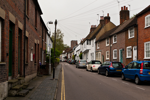
Image: © Ian Capper Taken: 3 May 2012
The old route into St Albans from London, as a continuation of Old London Road, until the building of the current London Road by Thomas Telford in the late 18th century. All the buildings on the north (right hand side here) side of the road are either grade II listed or locally listed, reflecting its historic importance and its preservation as a medieval route, whilst those on the south in this photo (left hand side here) are all locally listed. On the wall of the first building on the left can be seen a World War 1 Street Memorial (see Image for close up). In the background is St Albans Abbey.
Images are licensed for reuse under creativecommons.org/licenses/by-sa/2.0
Image Location
Latitude
51.748356
Longitude
-0.338119