Nottingham - NG6 (Bulwell)
Introduction
The photograph on this page of Nottingham - NG6 (Bulwell) by David Hallam-Jones as part of the Geograph project.
The Geograph project started in 2005 with the aim of publishing, organising and preserving representative images for every square kilometre of Great Britain, Ireland and the Isle of Man.

There are currently over 7.5m images from over 14,400 individuals and you can help contribute to the project by visiting https://www.geograph.org.uk
Nottingham - NG6 (Bulwell)
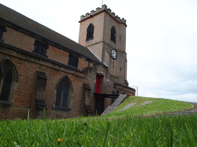
Image: © David Hallam-Jones Taken: 4 May 2012
A steep path plus a bridge that allow wheelchair users access to Bulwell Parish Church. Vehicles are compelled to use the steep drive to reach the church car park situated to the right of where the photographer is standing. Wheelchairs then need to be propelled under the bridge, along the side of the church and finally up this steep path in order to reach the side door seen here.
Images are licensed for reuse under creativecommons.org/licenses/by-sa/2.0
Image Location
Latitude
53.000039
Longitude
-1.194138