Bricklayers Arms
Introduction
The photograph on this page of Bricklayers Arms by Stephen McKay as part of the Geograph project.
The Geograph project started in 2005 with the aim of publishing, organising and preserving representative images for every square kilometre of Great Britain, Ireland and the Isle of Man.

There are currently over 7.5m images from over 14,400 individuals and you can help contribute to the project by visiting https://www.geograph.org.uk
Bricklayers Arms
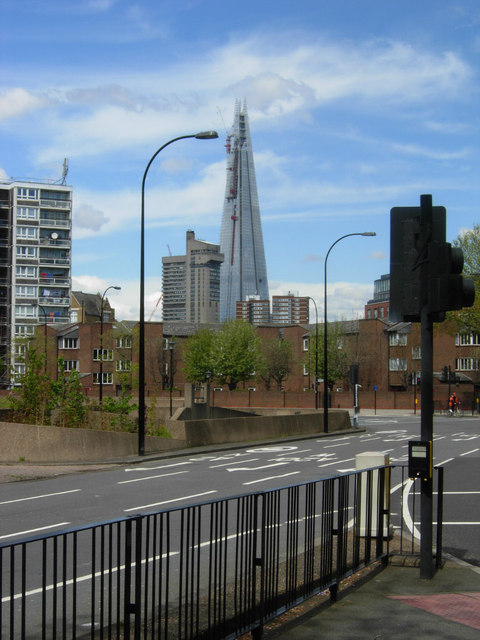
Image: © Stephen McKay Taken: 30 Apr 2012
The original Bricklayers Arms was a coaching inn on the road to Dover, but nowadays the name is used for this traffic roundabout, curiously quiet in this Monday lunchtime view. The Shard at London Bridge overlooks the scene. The Bricklayers Arms name was also used by a nearby railway goods depot which ended its days in 1981 as the principal parcels concentration depot for London when British Rail closed its collection and delivery service. It had become notorious for pilfering on an industrial scale - in 1980 three British Transport policemen were convicted of being in on the racket. That's all history now and the site has become housing.
Images are licensed for reuse under creativecommons.org/licenses/by-sa/2.0
Image Location
Latitude
51.4943
Longitude
-0.0851