Eglwyswrw church
Introduction
The photograph on this page of Eglwyswrw church by Natasha Ceridwen de Chroustchoff as part of the Geograph project.
The Geograph project started in 2005 with the aim of publishing, organising and preserving representative images for every square kilometre of Great Britain, Ireland and the Isle of Man.

There are currently over 7.5m images from over 14,400 individuals and you can help contribute to the project by visiting https://www.geograph.org.uk
Eglwyswrw church
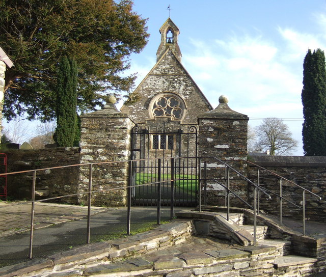
Image: © Natasha Ceridwen de Chroustchoff Taken: 11 Dec 2006
This Victorian reconstruction of an more modest earlier building is dedicated to Christiolus, a 7th century Welsh saint, although the name of the village, Eglwyswrw, is often translated as 'Wrw's church'. (However there may be an alternative explanation for the name, see Image) The saint's day, November 3, was traditionally celebrated in the parish.
Images are licensed for reuse under creativecommons.org/licenses/by-sa/2.0
Image Location


Leaflet Map data © OpenStreetMap
Latitude
52.012841
Longitude
-4.708811