St George's
Introduction
The photograph on this page of St George's by David Dixon as part of the Geograph project.
The Geograph project started in 2005 with the aim of publishing, organising and preserving representative images for every square kilometre of Great Britain, Ireland and the Isle of Man.

There are currently over 7.5m images from over 14,400 individuals and you can help contribute to the project by visiting https://www.geograph.org.uk
St George's
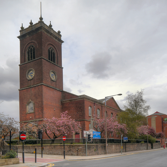
Image: © David Dixon Taken: 27 Apr 2012
The Church of Saint George was built in 1796. After closure in the latter half of the twentieth century it was used as a craft centre; the large sign partially obscuring the war memorial reads “St Georges Shops”. It now appears to be empty. The Church of St George was designated as a Grade II* listed building in 1974 (http://www.britishlistedbuildings.co.uk/en-476250-church-of-st-george-bolton British Listed Buildings).
Images are licensed for reuse under creativecommons.org/licenses/by-sa/2.0
Image Location
Latitude
53.582124
Longitude
-2.430587