Corve Street
Introduction
The photograph on this page of Corve Street by Ian Capper as part of the Geograph project.
The Geograph project started in 2005 with the aim of publishing, organising and preserving representative images for every square kilometre of Great Britain, Ireland and the Isle of Man.

There are currently over 7.5m images from over 14,400 individuals and you can help contribute to the project by visiting https://www.geograph.org.uk
Corve Street
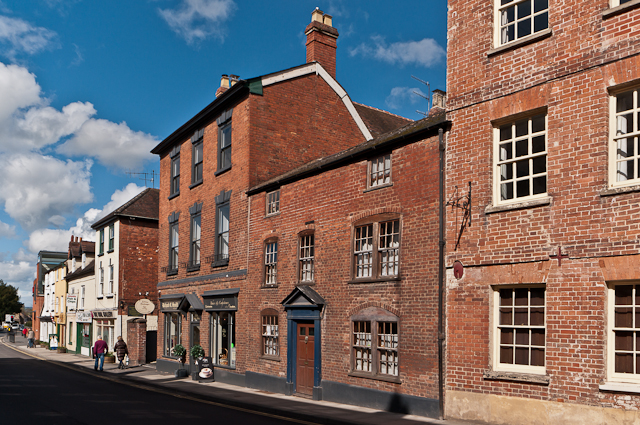
Image: © Ian Capper Taken: 10 Apr 2012
Grade II listed buildings in Corve Street. On the right is part of no 137: late 18th century brick frontage to a 17th century core - see www.historicengland.org.uk/listing/the-list/list-entry/1202774. For complete view see Image Next to it is no 136: early 18th century - see www.historicengland.org.uk/listing/the-list/list-entry/1290571. Then no 135: late 18th/early 19th century brick frontage on 17th century core - see www.historicengland.org.uk/listing/the-list/list-entry/1202773. For closer view see Image Beyond the gap, with a painted brick front, no 134: late C18/early C19 front to C18 core - see www.historicengland.org.uk/listing/the-list/list-entry/1221218. For the buildings beyond, see Image
Images are licensed for reuse under creativecommons.org/licenses/by-sa/2.0
Image Location
Latitude
52.370165
Longitude
-2.71871