South Sands at Troon
Introduction
The photograph on this page of South Sands at Troon by M J Richardson as part of the Geograph project.
The Geograph project started in 2005 with the aim of publishing, organising and preserving representative images for every square kilometre of Great Britain, Ireland and the Isle of Man.

There are currently over 7.5m images from over 14,400 individuals and you can help contribute to the project by visiting https://www.geograph.org.uk
South Sands at Troon
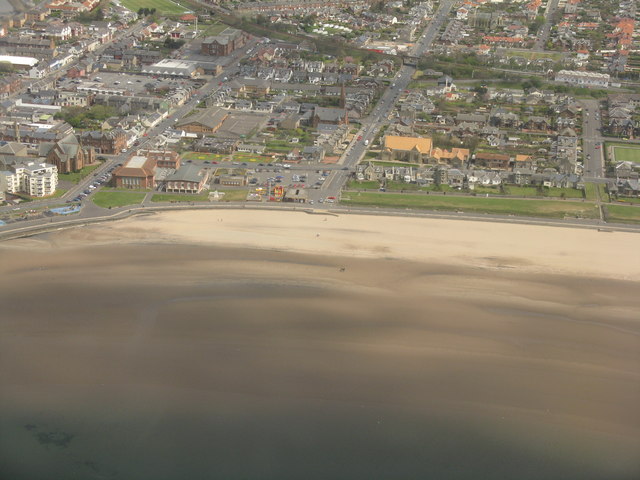
Image: © M J Richardson Taken: 29 Apr 2012
Looking northeast along St Meddans Street, which passes under the railway, with the station the light building at top right. The light brick-red building near the centre is Portland Parish Church, and the other churches, to the left are St Meddans and Troon Old Parish Church.
Images are licensed for reuse under creativecommons.org/licenses/by-sa/2.0
Image Location
Latitude
55.542272
Longitude
-4.659385