Nottingham - NG7
Introduction
The photograph on this page of Nottingham - NG7 by David Hallam-Jones as part of the Geograph project.
The Geograph project started in 2005 with the aim of publishing, organising and preserving representative images for every square kilometre of Great Britain, Ireland and the Isle of Man.

There are currently over 7.5m images from over 14,400 individuals and you can help contribute to the project by visiting https://www.geograph.org.uk
Nottingham - NG7
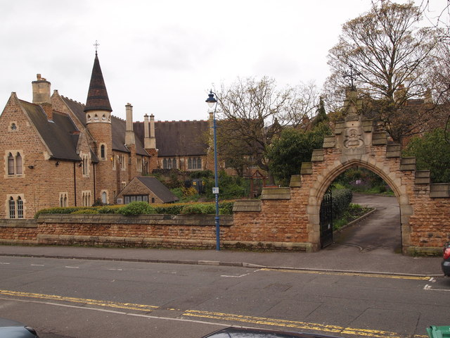
Image: © David Hallam-Jones Taken: 28 Apr 2012
This driveway off Raleigh Street allows access to a cluster of buildings; the former All Saints' School, the former headmaster's house, Holy Trinity Church and the vicarage. The school ceased to operate as a school in 1905 and is currently owned (in 2014) by a Nigerian congregation. The eastern half of the vicarage is now the vicar's current residence and the other half - now called All Saints House - is currently let to students of Nottingham Trent University.
Images are licensed for reuse under creativecommons.org/licenses/by-sa/2.0
Image Location
Latitude
52.9599
Longitude
-1.161388