Allotment at The Butts, Warkworth
Introduction
The photograph on this page of Allotment at The Butts, Warkworth by Andrew Curtis as part of the Geograph project.
The Geograph project started in 2005 with the aim of publishing, organising and preserving representative images for every square kilometre of Great Britain, Ireland and the Isle of Man.

There are currently over 7.5m images from over 14,400 individuals and you can help contribute to the project by visiting https://www.geograph.org.uk
Allotment at The Butts, Warkworth
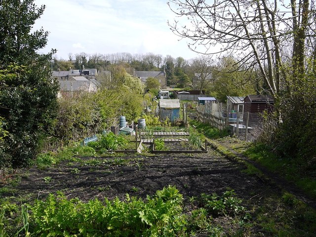
Image: © Andrew Curtis Taken: 22 Apr 2012
In Northumberland, 'The Butts' were what was left over at the end of the field after ploughing. In Warkworth, the loop of the River Coquet provided two limits to the extent of the medieval settlement - the Stanners on the west and The Butts to the east. Pevsner described the layout of Warkworth as "entirely medieval" with long burgage strips extending both west and east from properties on Castle Street and Bridge Street. The photo is taken from the Ember Path Image, which runs east of, and parallel to, Castle Street. The long narrow burgage strips are still in use by local residents as allotments and gardens, and are still well preserved on current maps and in aerial view. Warkworth Conservation Area Character Appraisal: http://www.northumberland.gov.uk/idoc.ashx?docid=656f3a85-465b-4585-bc76-4d9aca17eb9f&version=-1
Images are licensed for reuse under creativecommons.org/licenses/by-sa/2.0
Image Location
Latitude
55.347408
Longitude
-1.610482