Titania Street, Belfast
Introduction
The photograph on this page of Titania Street, Belfast by Albert Bridge as part of the Geograph project.
The Geograph project started in 2005 with the aim of publishing, organising and preserving representative images for every square kilometre of Great Britain, Ireland and the Isle of Man.

There are currently over 7.5m images from over 14,400 individuals and you can help contribute to the project by visiting https://www.geograph.org.uk
Titania Street, Belfast
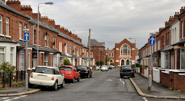
Image: © Albert Bridge Taken: 26 Apr 2012
A street, dating from around the end of the 19th century, running from Earl Haig Park to the Cregagh Road. Cregagh Methodist church Image is in the background. In common with most of the streets in the area, it has not been redeveloped and still retains the original terrace houses. Previously seen in Image (July 2009).
Images are licensed for reuse under creativecommons.org/licenses/by-sa/2.0
Image Location
Latitude
54.584503
Longitude
-5.900557