Southcote Road
Introduction
The photograph on this page of Southcote Road by Ian Capper as part of the Geograph project.
The Geograph project started in 2005 with the aim of publishing, organising and preserving representative images for every square kilometre of Great Britain, Ireland and the Isle of Man.

There are currently over 7.5m images from over 14,400 individuals and you can help contribute to the project by visiting https://www.geograph.org.uk
Southcote Road
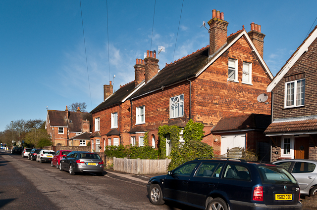
Image: © Ian Capper Taken: 21 Apr 2012
Late Victorian cottages in this road linking Albury Road and Nutfield Road. Although they are identical in appearance, the 1896 1:2500 map only shows the left hand of the pair, with the rest of the road undeveloped.
Images are licensed for reuse under creativecommons.org/licenses/by-sa/2.0
Image Location
Latitude
51.257071
Longitude
-0.149363