Nottingham - NG3
Introduction
The photograph on this page of Nottingham - NG3 by David Hallam-Jones as part of the Geograph project.
The Geograph project started in 2005 with the aim of publishing, organising and preserving representative images for every square kilometre of Great Britain, Ireland and the Isle of Man.

There are currently over 7.5m images from over 14,400 individuals and you can help contribute to the project by visiting https://www.geograph.org.uk
Nottingham - NG3
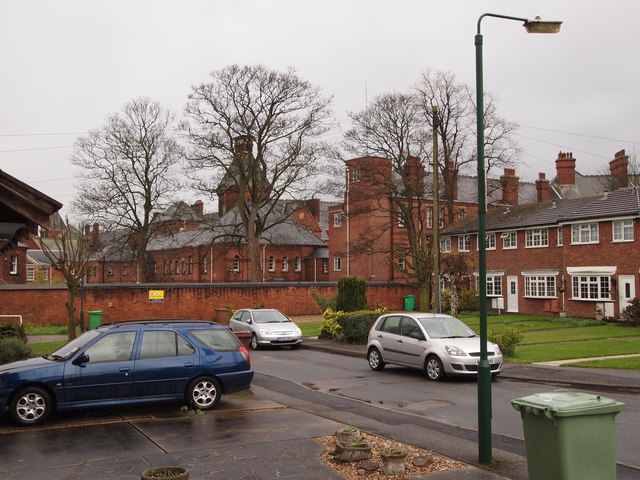
Image: © David Hallam-Jones Taken: 21 Apr 2012
Eaton Street, off the B684 (Woodborough Rd), comes to a dead end here where it reaches the boundary wall of what was once Mapperley psychiatric hospital. Originally called the Nottingham Borough Asylum it was designed to meet the needs of the city’s 70,000 inhabitants. However, by the time it was opened in 1880 the population of the borough had swollen to 180,000, placing an even heavier demand on it than had been envisaged. Most of the hospital was closed years ago as part of a governmental "Care in the Community" strategy although parts of it continue to provide mental health care facilities.
Images are licensed for reuse under creativecommons.org/licenses/by-sa/2.0
Image Location
Latitude
52.980328
Longitude
-1.127035