
Hugh Baird College, Stanley Road, Bootle
Introduction
The photograph on this page of Hugh Baird College, Stanley Road, Bootle by Stephen Richards as part of the Geograph project.
The Geograph project started in 2005 with the aim of publishing, organising and preserving representative images for every square kilometre of Great Britain, Ireland and the Isle of Man.

There are currently over 7.5m images from over 14,400 individuals and you can help contribute to the project by visiting https://www.geograph.org.uk
Hugh Baird College, Stanley Road, Bootle
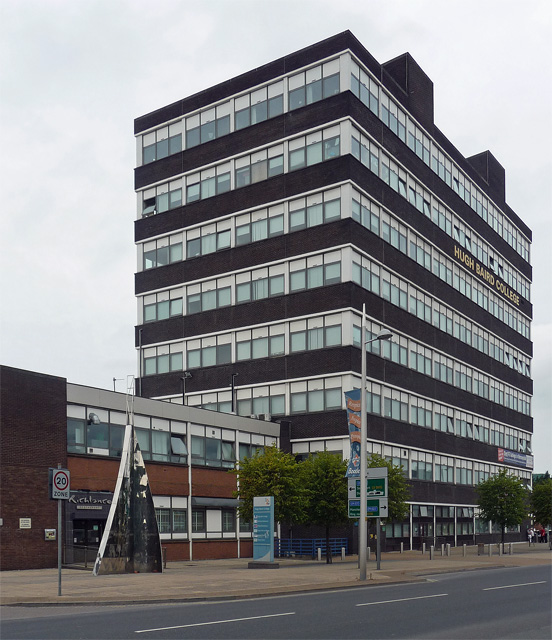
Image: © Stephen Richards Taken: 28 Jul 2011
Built 1966-68 by the Borough Architect, Thomas Finlay. Improbable as it may seem, Pevsner adduces Bootle as perhaps the nearest we come (or came) in this country to a Corbusian vision. Prompted by the need to revive a flagging economy previously reliant on the docks and the arrival of the Inland Revenue, in the mid 1960s the planners in Bootle, guided by the precepts of the French modernist architect, Le Corbusier, embarked on an ambitious reinvention of the town. Stanley Road was lined with towers and slabs, but, as Pevsner points out, the vision was undermined by the survival of older buildings in their midst. More recently, at least one has been demolished (Image]). Originally the Bootle College of Further Education, it now has more than 7,000 students aged 14-19 studying a variety of courses.
Images are licensed for reuse under creativecommons.org/licenses/by-sa/2.0
Image Location

Latitude
53.445053
Longitude
-2.989433