2012 : Railway side line north of Westerleigh
Introduction
The photograph on this page of 2012 : Railway side line north of Westerleigh by Maurice Pullin as part of the Geograph project.
The Geograph project started in 2005 with the aim of publishing, organising and preserving representative images for every square kilometre of Great Britain, Ireland and the Isle of Man.

There are currently over 7.5m images from over 14,400 individuals and you can help contribute to the project by visiting https://www.geograph.org.uk
2012 : Railway side line north of Westerleigh
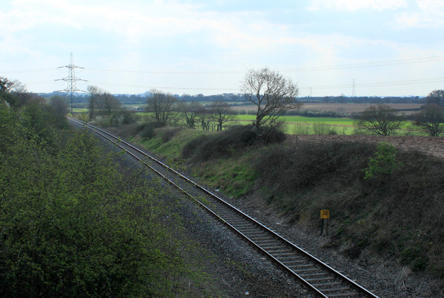
Image: © Maurice Pullin Taken: 2 Apr 2012
This was formerly the Midland Railway main line from Birmingham and Gloucester running via Mangotsfield into Bristol St Philips Station which was built by the Midland Railway in Midland Road, opened in 1870, with a later link to Temple Meads Station. St Philips Station was renamed Midland Road Station in 1952 when it was a goods station. http://en.wikipedia.org/wiki/Bristol_St_Philips_railway_station The line also ran via Mangotsfield North Junction to Bath (Queens Square, later Green Park). Following the "Beeching" cuts in the 1960s, the main line trains have run over the former GWR loop line from Yate South Junction (on right here) and via Westerleigh West and Filton Junctions into Bristol, leaving the single line stump as far as the Rail Head (former Westerleigh Sidings) two miles further on. Thanks to Ben Brooksbank for additional material.
Images are licensed for reuse under creativecommons.org/licenses/by-sa/2.0
Image Location


Leaflet Map data © OpenStreetMap
Latitude
51.528712
Longitude
-2.437887