White Oak farmhouse
Introduction
The photograph on this page of White Oak farmhouse by Gordon Hatton as part of the Geograph project.
The Geograph project started in 2005 with the aim of publishing, organising and preserving representative images for every square kilometre of Great Britain, Ireland and the Isle of Man.

There are currently over 7.5m images from over 14,400 individuals and you can help contribute to the project by visiting https://www.geograph.org.uk
White Oak farmhouse
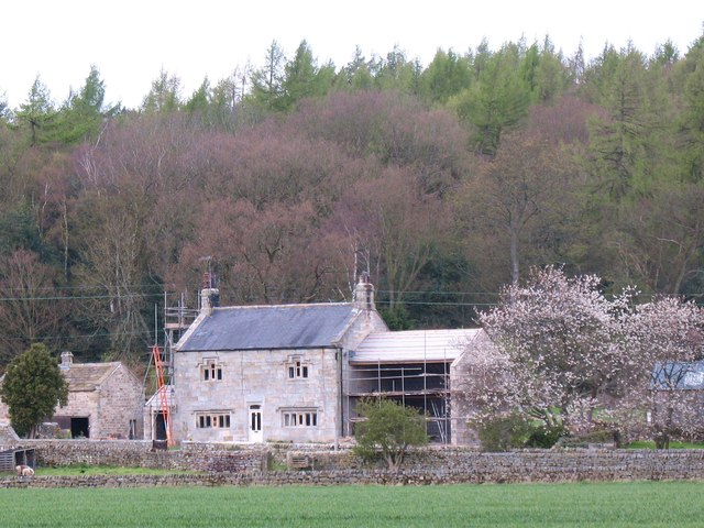
Image: © Gordon Hatton Taken: 15 Apr 2012
A nineteenth century rebuild of a 17th century house in Nidderdale. An odd combination of old looking stone mullioned windows with a slate roof and 20th century doorway. The house is grade 2 listed.
Images are licensed for reuse under creativecommons.org/licenses/by-sa/2.0
Image Location


Leaflet Map data © OpenStreetMap
Latitude
54.034926
Longitude
-1.679336