Grade II* listed Capel Pendref, Caernarfon
Introduction
The photograph on this page of Grade II* listed Capel Pendref, Caernarfon by Jaggery as part of the Geograph project.
The Geograph project started in 2005 with the aim of publishing, organising and preserving representative images for every square kilometre of Great Britain, Ireland and the Isle of Man.

There are currently over 7.5m images from over 14,400 individuals and you can help contribute to the project by visiting https://www.geograph.org.uk
Grade II* listed Capel Pendref, Caernarfon
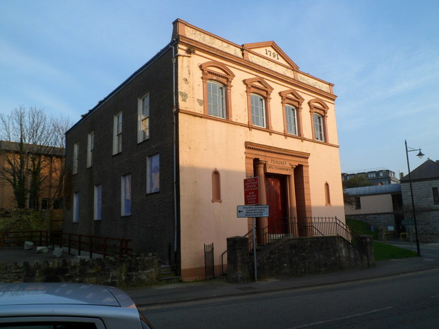
Image: © Jaggery Taken: 23 Mar 2012
The chapel is at the northern edge of Caernarfon town centre, on the corner of Bangor Street and Ffordd Pafiliwn (Pavilion Road). The year showing at the top of the building is 1791, recording the building of the original chapel. The present-day chapel, dating from 1891, is the last of several rebuilds in the 19th century. Grade II* listed in March 1983.
Images are licensed for reuse under creativecommons.org/licenses/by-sa/2.0
Image Location
Latitude
53.141505
Longitude
-4.273916