Trefael stone
Introduction
The photograph on this page of Trefael stone by Natasha Ceridwen de Chroustchoff as part of the Geograph project.
The Geograph project started in 2005 with the aim of publishing, organising and preserving representative images for every square kilometre of Great Britain, Ireland and the Isle of Man.

There are currently over 7.5m images from over 14,400 individuals and you can help contribute to the project by visiting https://www.geograph.org.uk
Trefael stone
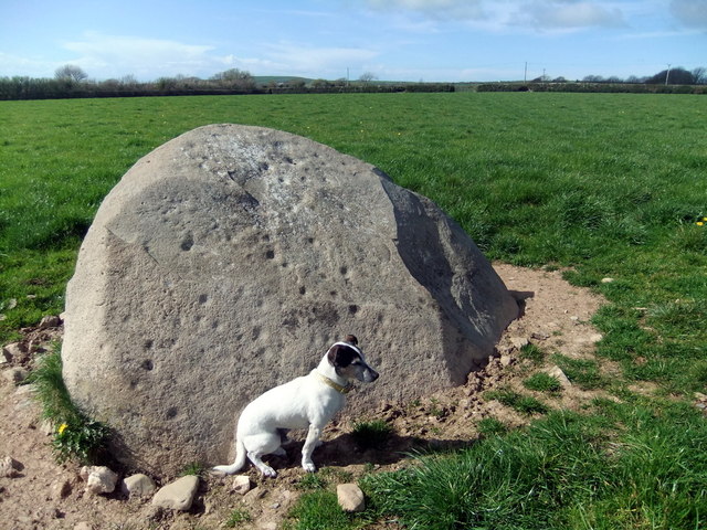
Image: © Natasha Ceridwen de Chroustchoff Taken: 11 Apr 2012
This ancient monument, marked on the OS map as 'cup-marked stone' close to a footpath running south from Bayvil, has recently been excavated by archaeologists from the University of Bristol. As a result it has been re-classified from a standing stone to the capstone of a portal dolmen. Beads, pottery, charcoal and human bone have been discovered and further examination and radio-carbon dating is intended. The stone carries 75 cup-marks. It is thought the site was used over a period of many thousands of years. See http://bristol.ac.uk/news/2012/8394.html and http://www.pasthorizonspr.com/index.php/archives/10/2011/new-discoveries-at-trefael-stone-in-wales for further information.
Images are licensed for reuse under creativecommons.org/licenses/by-sa/2.0
Image Location
Latitude
52.028308
Longitude
-4.766897