Cornwall - Mevagissey
Introduction
The photograph on this page of Cornwall - Mevagissey by David Hallam-Jones as part of the Geograph project.
The Geograph project started in 2005 with the aim of publishing, organising and preserving representative images for every square kilometre of Great Britain, Ireland and the Isle of Man.

There are currently over 7.5m images from over 14,400 individuals and you can help contribute to the project by visiting https://www.geograph.org.uk
Cornwall - Mevagissey
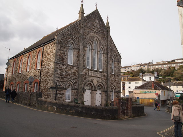
Image: © David Hallam-Jones Taken: 6 Apr 2012
In 1815 William O'Bryan (a.k.a Bryant) from Luxulyan initiated a breakaway movement from Methodism with its followers referring to themselves Bible Christians. In parts of Cornwall this non-conformist branch was even more popular than that of the Wesleyans. As was the case here, many towns and villages had both a Wesleyan and a Bible Christian Chapel. This chapel, located at the end of the one-way traffic system leading out of the village, has been converted into residential accommodation.
Images are licensed for reuse under creativecommons.org/licenses/by-sa/2.0
Image Location
Latitude
50.270842
Longitude
-4.789145