"Beechlawn", Hillsborough
Introduction
The photograph on this page of "Beechlawn", Hillsborough by Albert Bridge as part of the Geograph project.
The Geograph project started in 2005 with the aim of publishing, organising and preserving representative images for every square kilometre of Great Britain, Ireland and the Isle of Man.

There are currently over 7.5m images from over 14,400 individuals and you can help contribute to the project by visiting https://www.geograph.org.uk
"Beechlawn", Hillsborough
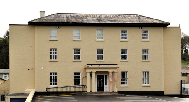
Image: © Albert Bridge Taken: 9 Apr 2012
This building (previously seen Image in November 2005) was built as the rectory for St Malachi’s parish church Image of 1772. The construction of the church was the gift of Wills Hill the then Earl of Hillsborough. He hoped (in vain as matters turned out) that the church would eventually become a cathedral. The rectory, on the Dromore Road, is in a style befitting the residence of a bishop. It was extended after construction but there does not seem to be any indication of its original size except that it was recorded as having three storeys. I have not been able to discover the date of construction of the original house or the later extension but the former might be supposed to be approximately contemporary with that of the church. The 1830’s OS map shows a “Glebe House” in wooded grounds on the site. Now in educational use http://www.beechlawnschool.co.uk/ .
Images are licensed for reuse under creativecommons.org/licenses/by-sa/2.0
Image Location
Latitude
54.458473
Longitude
-6.086373