Solway Junction Railway
Introduction
The photograph on this page of Solway Junction Railway by Andy Farrington as part of the Geograph project.
The Geograph project started in 2005 with the aim of publishing, organising and preserving representative images for every square kilometre of Great Britain, Ireland and the Isle of Man.

There are currently over 7.5m images from over 14,400 individuals and you can help contribute to the project by visiting https://www.geograph.org.uk
Solway Junction Railway
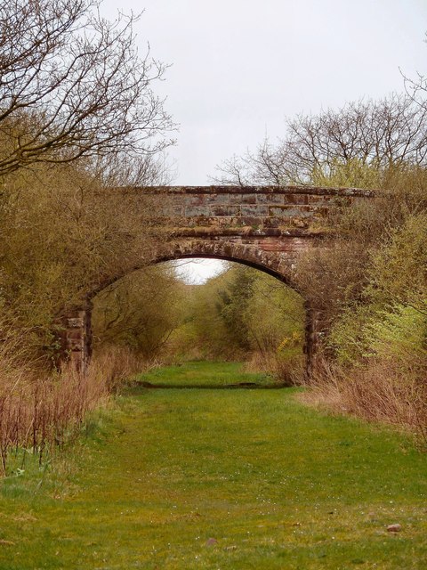
Image: © Andy Farrington Taken: 3 Apr 2012
This bridge carries Hospital Road in Annan over the former railway branch line which was part of the Caledonian Railway known as the Solway Junction Railway, running between Kirtlebridge and Annan then crossing the Solway Firth by a 1,940 yard (1,791 m) viaduct to Bowness-on-Solway and Whitrigg. The line was opened with Caledonian Railway backing completely by 8 August 1870. The Scottish part was bought by the Caledonian Railway on 5 August 1873 and the whole line on 6 July 1895. It joined up with the Maryport and Carlisle Railway. This line sought to bring iron ore and hematite from Cumberland to the Lanarkshire steelworks. http://en.wikipedia.org/wiki/Caledonian_Railway
Images are licensed for reuse under creativecommons.org/licenses/by-sa/2.0
Image Location
Latitude
54.995618
Longitude
-3.244036