Embankment at Ruddington Lane Park
Introduction
The photograph on this page of Embankment at Ruddington Lane Park by Alan Murray-Rust as part of the Geograph project.
The Geograph project started in 2005 with the aim of publishing, organising and preserving representative images for every square kilometre of Great Britain, Ireland and the Isle of Man.

There are currently over 7.5m images from over 14,400 individuals and you can help contribute to the project by visiting https://www.geograph.org.uk
Embankment at Ruddington Lane Park
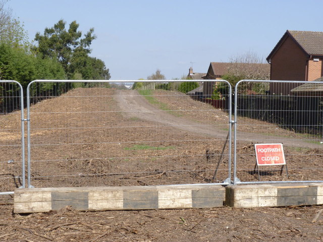
Image: © Alan Murray-Rust Taken: 1 Apr 2012
All the vegetation has been cleared from the former railway embankment to allow construction of the new tramway. The works involve closure of the footpath along the trackbed, but this will be reinstated when construction is complete. This will be the location for the Compton Acres tram stop.
Images are licensed for reuse under creativecommons.org/licenses/by-sa/2.0
Image Location
Latitude
52.919329
Longitude
-1.157413