Rhyd y Darren Ford
Introduction
The photograph on this page of Rhyd y Darren Ford by Alan Richards as part of the Geograph project.
The Geograph project started in 2005 with the aim of publishing, organising and preserving representative images for every square kilometre of Great Britain, Ireland and the Isle of Man.

There are currently over 7.5m images from over 14,400 individuals and you can help contribute to the project by visiting https://www.geograph.org.uk
Rhyd y Darren Ford
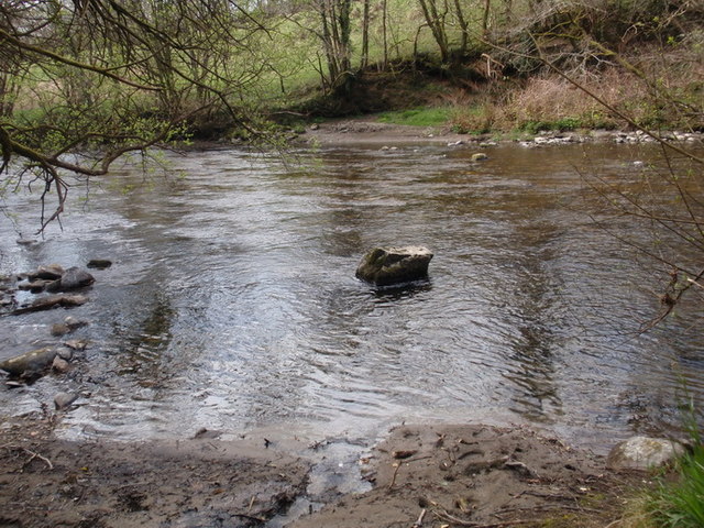
Image: © Alan Richards Taken: 5 Apr 2012
Rhyd hynafol yn rhydio Afon Cothi gerllaw Ffarm y Darren Fawr. Ymddengys fod y groesfan hon yn un beryglus iawn a thybiaf fod ambell un wedi boddi yma dros y canrifoedd wrth geisio ei chroesi. Mae lefel y dwr yn isel wedi prinder o law. I'r dde o'r llun mae pontdroed. An ancient ford crossing on the Cothi River near Darren Fawr Farm. The road linked Brechfa with Llanfynydd. The ford appears to be very dangerous and it seems very likely that people have drowned here over the centuries. The river is actually very low due to the lack of rain. To the right of the photo is a footbridge.
Images are licensed for reuse under creativecommons.org/licenses/by-sa/2.0
Image Location
Latitude
51.935254
Longitude
-4.130495