Leicester - Grand Union Canal/River Soar
Introduction
The photograph on this page of Leicester - Grand Union Canal/River Soar by David Hallam-Jones as part of the Geograph project.
The Geograph project started in 2005 with the aim of publishing, organising and preserving representative images for every square kilometre of Great Britain, Ireland and the Isle of Man.

There are currently over 7.5m images from over 14,400 individuals and you can help contribute to the project by visiting https://www.geograph.org.uk
Leicester - Grand Union Canal/River Soar
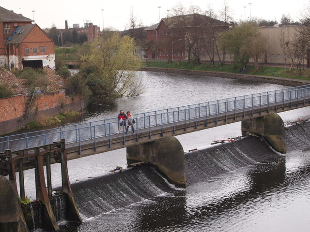
Image: © David Hallam-Jones Taken: 31 Mar 2012
A walkway along the top of the weir that separates the Grand Union Canal and the River Soar allows pedestrians and cyclists to cross from the west bank and thus to access a number of footpaths on the eastern side of 'the Grand Union' and the Soar Lane cul-de-sac. The canal footpath disappearing into the distance leads to the stretch of canal alongside Castle Gardens and near to the De Monfort University site.
Images are licensed for reuse under creativecommons.org/licenses/by-sa/2.0
Image Location


Leaflet Map data © OpenStreetMap
Latitude
52.63768
Longitude
-1.144952