Leicester - City Centre
Introduction
The photograph on this page of Leicester - City Centre by David Hallam-Jones as part of the Geograph project.
The Geograph project started in 2005 with the aim of publishing, organising and preserving representative images for every square kilometre of Great Britain, Ireland and the Isle of Man.

There are currently over 7.5m images from over 14,400 individuals and you can help contribute to the project by visiting https://www.geograph.org.uk
Leicester - City Centre
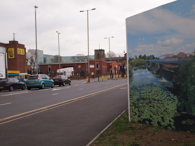
Image: © David Hallam-Jones Taken: 31 Mar 2012
Instead of leaving this demolition site at the junction of Soar Lane with Highcross Street untidy and ripe for misuse by fly-tippers and squatters Leicester City Council has arranged for a frieze of local scenes created by artist Helen Saunders to be mounted on these hoardings along this stretch of road as it enters the city centre. The Church in the distance is St Ann's, a decommissioned but carefully preserved Norman church dating from the 13th century. It is situated in High Cross Street (Leicester's original High Street). High Cross shopping centre is also visible on the horizon sporting a greeny-grey patterned side elevation.
Images are licensed for reuse under creativecommons.org/licenses/by-sa/2.0
Image Location
Latitude
52.639365
Longitude
-1.141668