The Worcester Park
Introduction
The photograph on this page of The Worcester Park by Des Blenkinsopp as part of the Geograph project.
The Geograph project started in 2005 with the aim of publishing, organising and preserving representative images for every square kilometre of Great Britain, Ireland and the Isle of Man.

There are currently over 7.5m images from over 14,400 individuals and you can help contribute to the project by visiting https://www.geograph.org.uk
The Worcester Park
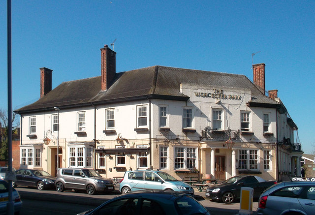
Image: © Des Blenkinsopp Taken: 26 Mar 2012
Large town pub on a corner opposite Worcester Park station. The following is from Wikipedia, on the origins of the name. "Worcester Park takes its name from the 4th Earl of Worcester, who was appointed Keeper of the Great Park in 1606. The area was once part of the Great Park which covered around 1100 acres and surrounded the Little Park which contained Nonsuch Palace of Henry VIII. Both parks were originally used as deer parks. Henry VIII had obtained the land from Sir Richard de Cuddington. During the ownership by Sir Richard de Cuddington, there was a manor house on a site which was later replaced by Worcester House and is now the site of Worcester Close. There was also a church of St. Mary on roughly the same site where the church of St. Mary the Virgin, Cuddington, now stands. The diarist Samuel Pepys visited the district and in his diary commented on Worcester House. In 1809 Worcester Park was acquired by William Taylor. He used a mill on the banks of the Hogsmill to continue the manufacture gunpowder which had been carried out on and off in the area for several centuries. Manufacturing continued until the 1850s when the mill blew up."
Images are licensed for reuse under creativecommons.org/licenses/by-sa/2.0
Image Location
Latitude
51.380825
Longitude
-0.246764