Lock at Spike Island
Introduction
The photograph on this page of Lock at Spike Island by Sue Adair as part of the Geograph project.
The Geograph project started in 2005 with the aim of publishing, organising and preserving representative images for every square kilometre of Great Britain, Ireland and the Isle of Man.

There are currently over 7.5m images from over 14,400 individuals and you can help contribute to the project by visiting https://www.geograph.org.uk
Lock at Spike Island
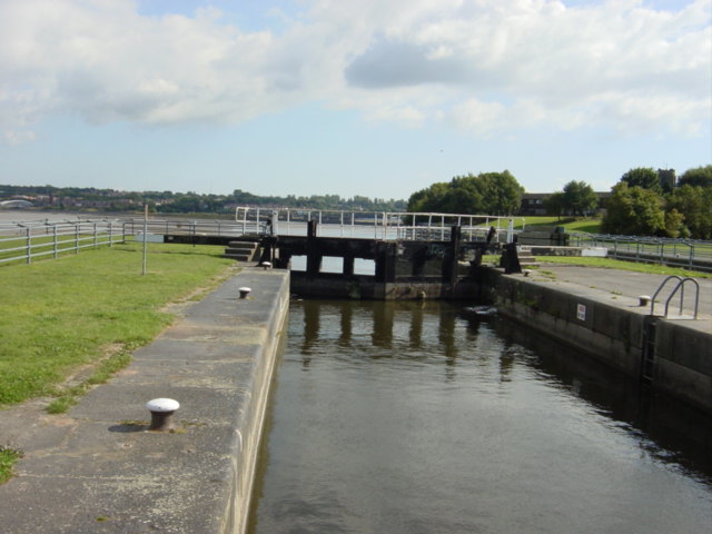
Image: © Sue Adair Taken: 20 Aug 2005
This locks allows access to the Mersey from the Sankey Navigation which was the first "canal" in Britain. This extension opened in 1833 with twin 79ft long locks and the whole canal officially closed in 1963 after 206 years. In 1982, following the closure of the numerous chemical works and factories on Spike Island and after seven years of cleaning and restoring, the area around the southern end of the canal was completely redeveloped and landscaped. A museum was opened in a former chemical works building and both the canal and Spike Island was opened to the public, providing a green open space for local people and a haven for pleasure craft.
Images are licensed for reuse under creativecommons.org/licenses/by-sa/2.0
Image Location
Latitude
53.35243
Longitude
-2.733089