Nottingwood House
Introduction
The photograph on this page of Nottingwood House by Derek Harper as part of the Geograph project.
The Geograph project started in 2005 with the aim of publishing, organising and preserving representative images for every square kilometre of Great Britain, Ireland and the Isle of Man.

There are currently over 7.5m images from over 14,400 individuals and you can help contribute to the project by visiting https://www.geograph.org.uk
Nottingwood House
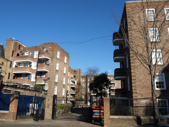
Image: © Derek Harper Taken: 19 Mar 2012
A development of flats built in the late 1930s on the site of the Kensington Park Brewery http://www.historytalk.org/Newsletter/HISTORYtalk%20Newsletter%2018.pdf , seen from Portland Road.
Images are licensed for reuse under creativecommons.org/licenses/by-sa/2.0
Image Location
Latitude
51.512506
Longitude
-0.213034