Junction at the top of Brooke Street
Introduction
The photograph on this page of Junction at the top of Brooke Street by Ann Cook as part of the Geograph project.
The Geograph project started in 2005 with the aim of publishing, organising and preserving representative images for every square kilometre of Great Britain, Ireland and the Isle of Man.

There are currently over 7.5m images from over 14,400 individuals and you can help contribute to the project by visiting https://www.geograph.org.uk
Junction at the top of Brooke Street
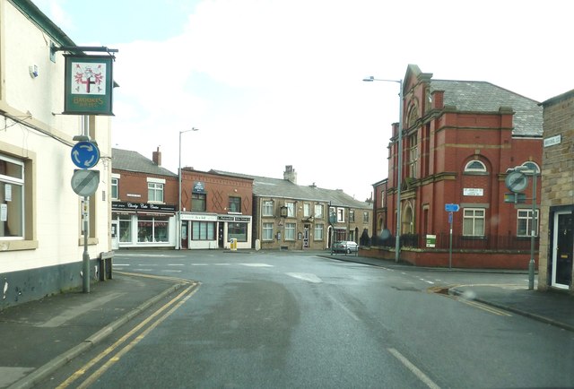
Image: © Ann Cook Taken: 18 Mar 2012
This is a staggered crossroads. Eaves Lane joins from the right, Cowling Brow goes left and St. James's Street leads to Yarrow Road on the right. There is a mini-roundabout in the centre of this junction. Two public houses can be seen - - Brookes Arms on the left and The Prince of Wales at the top of Cowling brow.
Images are licensed for reuse under creativecommons.org/licenses/by-sa/2.0
Image Location
Latitude
53.649618
Longitude
-2.617206