Bushbury Hill trig
Introduction
The photograph on this page of Bushbury Hill trig by Richard Law as part of the Geograph project.
The Geograph project started in 2005 with the aim of publishing, organising and preserving representative images for every square kilometre of Great Britain, Ireland and the Isle of Man.

There are currently over 7.5m images from over 14,400 individuals and you can help contribute to the project by visiting https://www.geograph.org.uk
Bushbury Hill trig
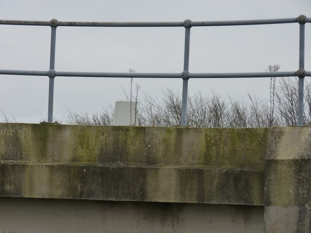
Image: © Richard Law Taken: 16 Mar 2012
The trig point lurks on the top of one of the concrete reservoir enclosures; pretty much inaccessible unless you're lucky enough to pass when there's a visiting employee of the water company (or you are willing to scale the 8-foot fence...which I wasn't). Otherwise its top is really only visible by climbing onto a fallen treetrunk on the other side of the bridleway.
Images are licensed for reuse under creativecommons.org/licenses/by-sa/2.0
Image Location
Latitude
52.619679
Longitude
-2.106603