The Romping Donkey at Hassall Green, Cheshire
Introduction
The photograph on this page of The Romping Donkey at Hassall Green, Cheshire by Roger D Kidd as part of the Geograph project.
The Geograph project started in 2005 with the aim of publishing, organising and preserving representative images for every square kilometre of Great Britain, Ireland and the Isle of Man.

There are currently over 7.5m images from over 14,400 individuals and you can help contribute to the project by visiting https://www.geograph.org.uk
The Romping Donkey at Hassall Green, Cheshire
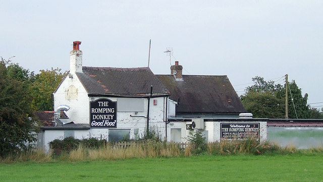
Image: © Roger D Kidd Taken: 31 Aug 2011
Seen from the Trent and Mersey Canal, the Romping Donkey is closed and boarded up. Whether that is due to the ineptness of Punch Taverns, who found they couldn't make enough profit quickly from a remote village hostelry, I know not. It was originally called The Red Lion, built in the 17th century, and is Grade II listed. Facebook postings (March 2012) suggest that it has been sold, the windows have been unboarded, and activity suggests it could well be re-opening as a pub quite soon. I hope so.
Images are licensed for reuse under creativecommons.org/licenses/by-sa/2.0
Image Location
Latitude
53.122492
Longitude
-2.330508