Crossrail construction west of Church Manorway
Introduction
The photograph on this page of Crossrail construction west of Church Manorway by Robin Webster as part of the Geograph project.
The Geograph project started in 2005 with the aim of publishing, organising and preserving representative images for every square kilometre of Great Britain, Ireland and the Isle of Man.

There are currently over 7.5m images from over 14,400 individuals and you can help contribute to the project by visiting https://www.geograph.org.uk
Crossrail construction west of Church Manorway
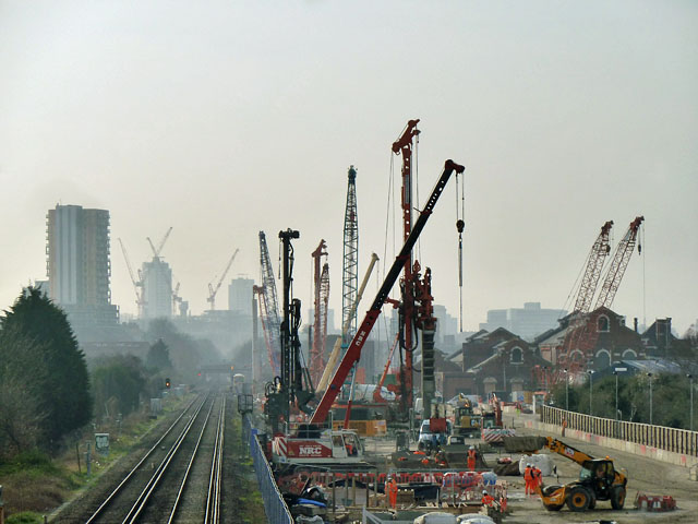
Image: © Robin Webster Taken: 14 Mar 2012
The nearer piledrivers and cranes are where the Crossrail tracks will come out of tunnel for the last time before reaching the terminus of the south branch at Abbey Wood. The viewpoint is on the Church Manorway footbridge, which will be reconstructed to allow four tracks on a widened present railway alignment. The two inner tracks will be Crossrail, so the current North Kent down track (the right-hand one) will be swung over to pass to the right of the emerging new tracks and so avoid a flat junction.
Images are licensed for reuse under creativecommons.org/licenses/by-sa/2.0
Image Location
Latitude
51.490363
Longitude
0.097679