SE boundary of Blaenavon
Introduction
The photograph on this page of SE boundary of Blaenavon by Jaggery as part of the Geograph project.
The Geograph project started in 2005 with the aim of publishing, organising and preserving representative images for every square kilometre of Great Britain, Ireland and the Isle of Man.

There are currently over 7.5m images from over 14,400 individuals and you can help contribute to the project by visiting https://www.geograph.org.uk
SE boundary of Blaenavon
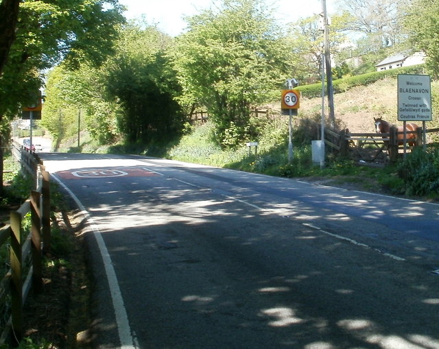
Image: © Jaggery Taken: 28 Apr 2011
Cwmavon Road reaches the Blaenavon boundary sign, a reduction in the speed limit from 40mph to 30mph, and an inquisitive horse! The sign shows that Blaenavon is twinned with Coutras, SW France. Most of Blaenavon is at an elevation at least 1,000 feet above mean sea level. This boundary, one of the lower parts of Blaenavon, is 1,010 feet (308 metres) above sea level.
Images are licensed for reuse under creativecommons.org/licenses/by-sa/2.0
Image Location
Latitude
51.767553
Longitude
-3.075212