Uncompleted Waterfront development at Bourne May Road in May 2011, Knott End-on-Sea
Introduction
The photograph on this page of Uncompleted Waterfront development at Bourne May Road in May 2011, Knott End-on-Sea by P L Chadwick as part of the Geograph project.
The Geograph project started in 2005 with the aim of publishing, organising and preserving representative images for every square kilometre of Great Britain, Ireland and the Isle of Man.

There are currently over 7.5m images from over 14,400 individuals and you can help contribute to the project by visiting https://www.geograph.org.uk
Uncompleted Waterfront development at Bourne May Road in May 2011, Knott End-on-Sea
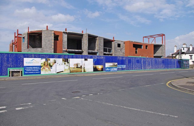
Image: © P L Chadwick Taken: 6 May 2011
Construction of this development of apartments came to a halt in 2008, because of falling demand in the housing market triggered by the financial crisis. The result was this eyesore, which is in a prominent position by the pier used by the ferry to Fleetwood. It seems that in late 2011 the developers submitted revised plans to the planning authority, with the hope that work could recommence in 2012 and be completed by the autumn of 2013.
Images are licensed for reuse under creativecommons.org/licenses/by-sa/2.0
Image Location


Leaflet Map data © OpenStreetMap
Latitude
53.928488
Longitude
-2.996419