The Charter Street Ragged School and Working Girls' Home
Introduction
The photograph on this page of The Charter Street Ragged School and Working Girls' Home by David Dixon as part of the Geograph project.
The Geograph project started in 2005 with the aim of publishing, organising and preserving representative images for every square kilometre of Great Britain, Ireland and the Isle of Man.

There are currently over 7.5m images from over 14,400 individuals and you can help contribute to the project by visiting https://www.geograph.org.uk
The Charter Street Ragged School and Working Girls' Home
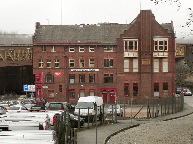
Image: © David Dixon Taken: 15 Mar 2012
The Charter Street Ragged School and Working Girls' Home at the corner of Aspin Lane and Dantzic Street, is a relatively rare surviving example of a purpose-built institution of this type. Originally the site of the Charter Street Mission, the first industrial school in Manchester, which opened in 1847, this school building was begun in 1866, and enlarged in 1891 and 1900. In 1892 it was renamed as "Charter Street Ragged School and Working Girls Home". See also: Image] Image] and Image] See Manchester history Net (http://manchesterhistory.net/manchester/tours/tour12/area12page42.html ) and Looking at Buildings (http://www.lookingatbuildings.org.uk/cities/manchester/walks-and-tours/socialprovision/ragged-schools-and-ashton-house.html ) for further information.
Images are licensed for reuse under creativecommons.org/licenses/by-sa/2.0
Image Location
Latitude
53.489546
Longitude
-2.236583