Former Roadside Chapel (Baptist), Rishworth
Introduction
The photograph on this page of Former Roadside Chapel (Baptist), Rishworth by Humphrey Bolton as part of the Geograph project.
The Geograph project started in 2005 with the aim of publishing, organising and preserving representative images for every square kilometre of Great Britain, Ireland and the Isle of Man.

There are currently over 7.5m images from over 14,400 individuals and you can help contribute to the project by visiting https://www.geograph.org.uk
Former Roadside Chapel (Baptist), Rishworth
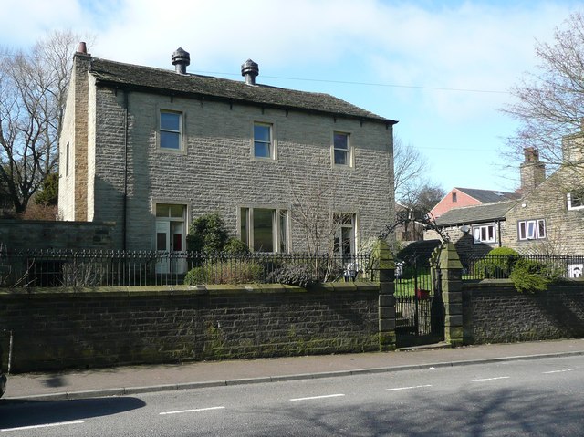
Image: © Humphrey Bolton Taken: 11 Mar 2012
The front does not look like a chapel, apart from the gate. The large ventilators on the roof are also unusual for a place of worship, although normal for meeting rooms of the late 19C. The 1893 1:2500 map shows that the two houses on the south side of the chapel were a post office and a Sunday School. On the 1907 map a large Sunday School had been built behind the chapel, which might also have been rebuilt or altered. This map also showed a small burial ground on the north side of the chapel.
Images are licensed for reuse under creativecommons.org/licenses/by-sa/2.0
Image Location
Latitude
53.659379
Longitude
-1.949573