Southampton Way Estate, SE5
Introduction
The photograph on this page of Southampton Way Estate, SE5 by Malc McDonald as part of the Geograph project.
The Geograph project started in 2005 with the aim of publishing, organising and preserving representative images for every square kilometre of Great Britain, Ireland and the Isle of Man.

There are currently over 7.5m images from over 14,400 individuals and you can help contribute to the project by visiting https://www.geograph.org.uk
Southampton Way Estate, SE5
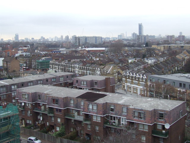
Image: © Malc McDonald Taken: 6 Mar 2012
A view from the 9th floor of a tower block on Southampton Way Estate, in Camberwell, South East London. The buildings in the foreground probably date from the 1960s or 1970s. Behind them are Victoria terraced houses. Further in the distance are several more blocks of flats built in the 1960s/70s. Several London landmarks are visible on the skyline, including Westminster Cathedral, the London Eye and the BT Tower.
Images are licensed for reuse under creativecommons.org/licenses/by-sa/2.0
Image Location
Latitude
51.477335
Longitude
-0.081491