Woodhall railway station
Introduction
The photograph on this page of Woodhall railway station by Thomas Nugent as part of the Geograph project.
The Geograph project started in 2005 with the aim of publishing, organising and preserving representative images for every square kilometre of Great Britain, Ireland and the Isle of Man.

There are currently over 7.5m images from over 14,400 individuals and you can help contribute to the project by visiting https://www.geograph.org.uk
Woodhall railway station
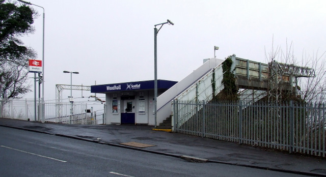
Image: © Thomas Nugent Taken: 27 Feb 2012
Now in a no-man's-land since the demolition of Woodhall Terrace and the partial demolition of Kelburn Terrace. Between Langbank and Port Glasgow on the Glasgow to Gourock & Wemyss Bay line, also known as the Inverclyde Line.
Images are licensed for reuse under creativecommons.org/licenses/by-sa/2.0
Image Location


Leaflet Map data © OpenStreetMap
Latitude
55.931112
Longitude
-4.655555