Southern boundary of Llancayo
Introduction
The photograph on this page of Southern boundary of Llancayo by Jaggery as part of the Geograph project.
The Geograph project started in 2005 with the aim of publishing, organising and preserving representative images for every square kilometre of Great Britain, Ireland and the Isle of Man.

There are currently over 7.5m images from over 14,400 individuals and you can help contribute to the project by visiting https://www.geograph.org.uk
Southern boundary of Llancayo
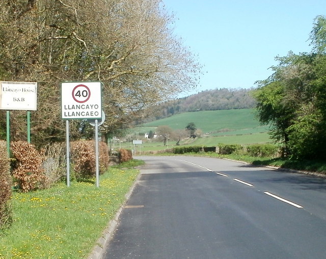
Image: © Jaggery Taken: 8 Apr 2011
Abergavenny Road (B4598) from Usk reaches the Monmouthshire hamlet of Llancayo (Llancaeo in Welsh). On the left of the Llancayo boundary sign is a sign for Llancayo House B&B (bed and breakfast accommodation).
Images are licensed for reuse under creativecommons.org/licenses/by-sa/2.0
Image Location
Latitude
51.721246
Longitude
-2.916315