Northbourne: Gulliver?s Trail passes through Puck?s Dell
Introduction
The photograph on this page of Northbourne: Gulliver?s Trail passes through Puck?s Dell by Chris Downer as part of the Geograph project.
The Geograph project started in 2005 with the aim of publishing, organising and preserving representative images for every square kilometre of Great Britain, Ireland and the Isle of Man.

There are currently over 7.5m images from over 14,400 individuals and you can help contribute to the project by visiting https://www.geograph.org.uk
Northbourne: Gulliver?s Trail passes through Puck?s Dell
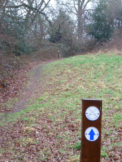
Image: © Chris Downer Taken: 4 Mar 2012
Looking along the central path of Image, a small open space hidden among the housing of suburban north Bournemouth. The waymarks of Gulliver's Trail are a recent instalment and, while I don't know an awful lot about it or exactly where it runs, it is connected with the smuggling ways prevalent in this area before Bournemouth existed and when the suburbs around here, such as Winton and Kinson, were separate small villages. Gulliver is perhaps the best known smuggler's name because of Jonathan Swift's novel Gulliver's Travels, and the path roughly leads to Kinson parish church, an important location for the storage of contraband in those bygone smuggling days. At the beginning of last month, the route was officially launched so I will get hold of the leaflet and provide more information when I have it!
Images are licensed for reuse under creativecommons.org/licenses/by-sa/2.0
Image Location
Latitude
50.762463
Longitude
-1.893893