The Talbot (closed), Worcester Road, Hartlebury
Introduction
The photograph on this page of The Talbot (closed), Worcester Road, Hartlebury by P L Chadwick as part of the Geograph project.
The Geograph project started in 2005 with the aim of publishing, organising and preserving representative images for every square kilometre of Great Britain, Ireland and the Isle of Man.

There are currently over 7.5m images from over 14,400 individuals and you can help contribute to the project by visiting https://www.geograph.org.uk
The Talbot (closed), Worcester Road, Hartlebury
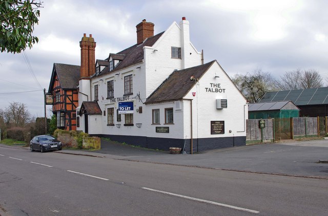
Image: © P L Chadwick Taken: 26 Feb 2012
Unfortunately the Talbot has been closed for quite some time, probably over a year. Some months ago there was a sign saying it was about to re-open, but obviously something went wrong, as it stayed firmly shut. It is now sporting a "to let" sign. With increased competition from the very successful new pub and restaurant by Hartlebury Railway Station, and the Talbot's goodwill long evaporated, any new licensee is going to have a battle on their hands to make a success of this old pub. The building itself started life as a farmhouse in the early 17th century, and it is a listed building. The pub when open:- Image Update March 2017:- After being closed for several years it seems the building will now be converted into residential use. Image
Images are licensed for reuse under creativecommons.org/licenses/by-sa/2.0
Image Location
Latitude
52.334256
Longitude
-2.227575