
Grainger Street, Newcastle-upon-Tyne
Introduction
The photograph on this page of Grainger Street, Newcastle-upon-Tyne by David Hillas as part of the Geograph project.
The Geograph project started in 2005 with the aim of publishing, organising and preserving representative images for every square kilometre of Great Britain, Ireland and the Isle of Man.

There are currently over 7.5m images from over 14,400 individuals and you can help contribute to the project by visiting https://www.geograph.org.uk
Grainger Street, Newcastle-upon-Tyne
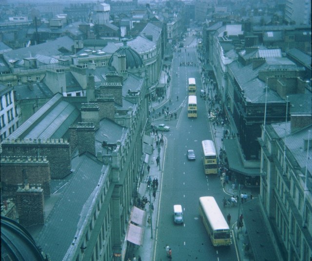
Image: © David Hillas Taken: 16 Aug 1969
Taken in August 1969, this photo shows Grainger Street looking South from the top of Grey's Monument. It was named after Richard Grainger who was a builder and developer of classical streets in the City Centre between 1824 and 1841. Four buses operated by Newcastle Corporation Transport can be seen, the one in front being a Leyland Panther single-decker with Alexander bodywork. Trolleybuses with overhead wiring used to run along this street until the system closed on the 1st October 1966. However, this section of Grainger Street is now a pedestrian zone.
Images are licensed for reuse under creativecommons.org/licenses/by-sa/2.0
Image Location

Latitude
54.973331
Longitude
-1.61364