Lethnot Parish Kirk
Introduction
The photograph on this page of Lethnot Parish Kirk by Anne Burgess as part of the Geograph project.
The Geograph project started in 2005 with the aim of publishing, organising and preserving representative images for every square kilometre of Great Britain, Ireland and the Isle of Man.

There are currently over 7.5m images from over 14,400 individuals and you can help contribute to the project by visiting https://www.geograph.org.uk
Lethnot Parish Kirk
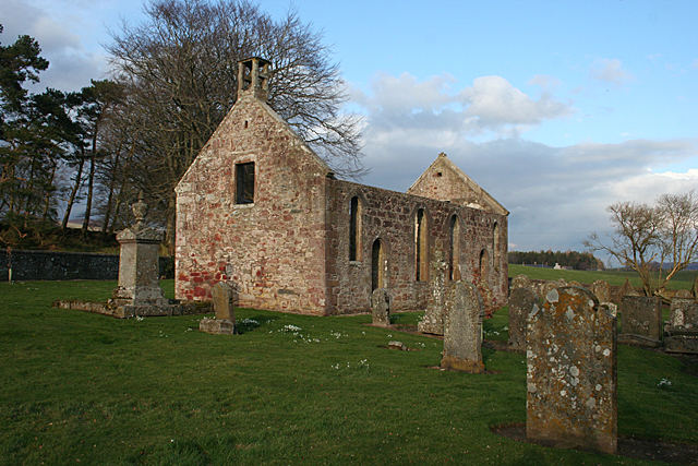
Image: © Anne Burgess Taken: 1 Mar 2012
The walls are all that remain of the kirk of Lethnot, plus a few old gravestones. I wonder how many more stones might be lurking buried in the grass? The building dates from about 1742, about twenty years after the parishes of Lethnot and Navar were united. The round-arched door and windows were inserted in 1820, and the interior, renovated in 1886, now contains nothing but two memorials to former parish ministers. Navar and Lethnot was linked with Menmuir for four years from 1938 after the then minister retired, but the link became permanent and the kirk at Lethnot, like that at Navar, became redundant and ruinous.
Images are licensed for reuse under creativecommons.org/licenses/by-sa/2.0
Image Location
Latitude
56.80324
Longitude
-2.751423