Sutton Mill Dam, St.Helens
Introduction
The photograph on this page of Sutton Mill Dam, St.Helens by andy as part of the Geograph project.
The Geograph project started in 2005 with the aim of publishing, organising and preserving representative images for every square kilometre of Great Britain, Ireland and the Isle of Man.

There are currently over 7.5m images from over 14,400 individuals and you can help contribute to the project by visiting https://www.geograph.org.uk
Sutton Mill Dam, St.Helens
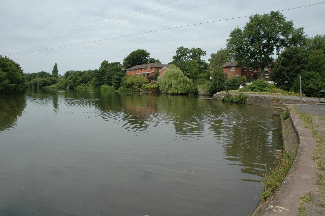
Image: © andy Taken: 17 Jul 2005
This is Sutton Mill Dam as seen from the dam end. It's right in the middle of two housing estates near Sutton Leach, St.Helens. Not too sure about its history but I think it's safe to say that it was built to serve a local mill. I couldn't find any signs of the mill but there was a Millhouse pub nearby. A local told me that a couple of years ago there was a fire close by and toxins were washed into the dam that, at the time, was a thriving fishing venue. The dam is now on the mend I believe.
Images are licensed for reuse under creativecommons.org/licenses/by-sa/2.0
Image Location


Leaflet Map data © OpenStreetMap
Latitude
53.425341
Longitude
-2.716284