Former Primitive Methodist Sunday School
Introduction
The photograph on this page of Former Primitive Methodist Sunday School by Bill Boaden as part of the Geograph project.
The Geograph project started in 2005 with the aim of publishing, organising and preserving representative images for every square kilometre of Great Britain, Ireland and the Isle of Man.

There are currently over 7.5m images from over 14,400 individuals and you can help contribute to the project by visiting https://www.geograph.org.uk
Former Primitive Methodist Sunday School
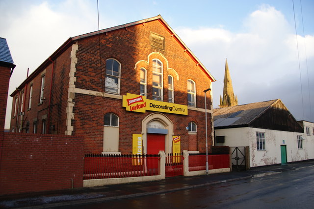
Image: © Bill Boaden Taken: 18 Feb 2012
It dates from 1883 but is now successfully used as commercial premises. Behind is the spire of St Luke's Church which also now has an alternative use.
Images are licensed for reuse under creativecommons.org/licenses/by-sa/2.0
Image Location
Latitude
53.766098
Longitude
-2.684905