
Baxters' Land lintel, Canonmills
Introduction
The photograph on this page of Baxters' Land lintel, Canonmills by kim traynor as part of the Geograph project.
The Geograph project started in 2005 with the aim of publishing, organising and preserving representative images for every square kilometre of Great Britain, Ireland and the Isle of Man.

There are currently over 7.5m images from over 14,400 individuals and you can help contribute to the project by visiting https://www.geograph.org.uk
Baxters' Land lintel, Canonmills
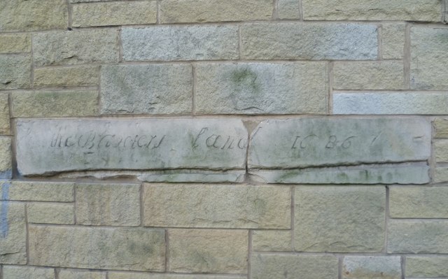
Image: © kim traynor Taken: 2 Feb 2012
The Incorporation of Baxters (bakers) in the Canongate were 'thirled' to the mills at Canonmills on the Water of Leith, i.e. compelled by law to have their corn ground there. During demolition work carried out in 1964 to enlarge a local filling station this stone was unearthed, bearing the inscription, "The Baxters Land 1686" (land being traditional Scots for a town tenement). It is now incorporated into a wall of the Canonmills Service Station. Image
Images are licensed for reuse under creativecommons.org/licenses/by-sa/2.0
Image Location

Latitude
55.962357
Longitude
-3.198305