South side Achalader
Introduction
The photograph on this page of South side Achalader by Ethel Tiller 1885-1946 as part of the Geograph project.
The Geograph project started in 2005 with the aim of publishing, organising and preserving representative images for every square kilometre of Great Britain, Ireland and the Isle of Man.

There are currently over 7.5m images from over 14,400 individuals and you can help contribute to the project by visiting https://www.geograph.org.uk
South side Achalader
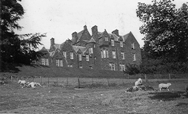
Image: © Ethel Tiller 1885-1946 Taken: Unknown
Photo date c1936, House pre-ruin, Modern photo by John Henderson Image shows that the some of the walls are still standing, so destruction possibly by fire but when?
Images are licensed for reuse under creativecommons.org/licenses/by-sa/2.0
Image Location
Latitude
56.5946
Longitude
-3.423125