No way through
Introduction
The photograph on this page of No way through by Michael Dibb as part of the Geograph project.
The Geograph project started in 2005 with the aim of publishing, organising and preserving representative images for every square kilometre of Great Britain, Ireland and the Isle of Man.

There are currently over 7.5m images from over 14,400 individuals and you can help contribute to the project by visiting https://www.geograph.org.uk
No way through
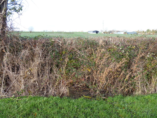
Image: © Michael Dibb Taken: 18 Dec 2011
The older version of the OS 1:25,000 map shows two public footpaths leaving the road to cut the corner to Oxstalls Farm (seen in the distance), one from near the last house and one from this point. On the newer version of the OS 1:25,000 map, only the footpath leaving the road at this point is shown. This view shows the bridge over the ditch but the stile is completely overgrown in the hedge.
Images are licensed for reuse under creativecommons.org/licenses/by-sa/2.0
Image Location
Latitude
52.114118
Longitude
-1.706721