Hearsall Common
Introduction
The photograph on this page of Hearsall Common by E Gammie as part of the Geograph project.
The Geograph project started in 2005 with the aim of publishing, organising and preserving representative images for every square kilometre of Great Britain, Ireland and the Isle of Man.

There are currently over 7.5m images from over 14,400 individuals and you can help contribute to the project by visiting https://www.geograph.org.uk
Hearsall Common
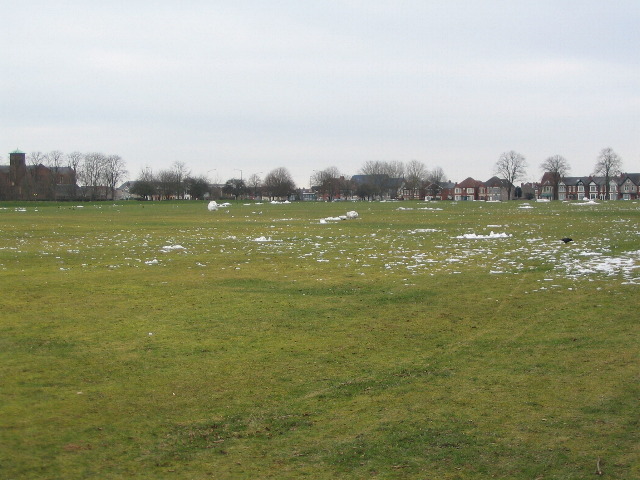
Image: © E Gammie Taken: 8 Feb 2012
Sub-zero overnight temperatures followed by a snowfall on the 4th, slight thaw and rain on the 5th then back to sub-zero on the past couple of days has left the ground rock-hard with patches of ice. Several giant snowballs created on Sunday are scattered in various stages of decomposition. On the skyline are All Souls church, left, the blue roof of St Mary Magdalen's and houses on Earlsdon Avenue North.
Images are licensed for reuse under creativecommons.org/licenses/by-sa/2.0
Image Location


Leaflet Map data © OpenStreetMap
Latitude
52.403691
Longitude
-1.536505