Norbury Park: the southernmost corner, after snow
Introduction
The photograph on this page of Norbury Park: the southernmost corner, after snow by Stefan Czapski as part of the Geograph project.
The Geograph project started in 2005 with the aim of publishing, organising and preserving representative images for every square kilometre of Great Britain, Ireland and the Isle of Man.

There are currently over 7.5m images from over 14,400 individuals and you can help contribute to the project by visiting https://www.geograph.org.uk
Norbury Park: the southernmost corner, after snow
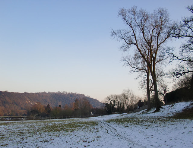
Image: © Stefan Czapski Taken: 7 Feb 2012
Taken on the afternoon of February 7th, following snowfall overnight on the 4th-5th. Meanwhile a good deal of snow had melted, but what was left on the ground had re-frozen, and was hard and crunchy (but easy to walk on). The view here is SE, across the Mole Gap, with Box Hill dominating the skyline. Norbury Park was acquired by Surrey County Council in the 1930's, with the aim of protecting it from development. It is currently managed by Surrey Wildlife Trust Countryside Services, with the grassland areas being grazed by sheep. Part of the site is an SSSI. The two fine trees on the slope are ashes. For a closer view, see Image
Images are licensed for reuse under creativecommons.org/licenses/by-sa/2.0
Image Location
Latitude
51.256062
Longitude
-0.330479