The Rawbrae Road near Whitehead
Introduction
The photograph on this page of The Rawbrae Road near Whitehead by Albert Bridge as part of the Geograph project.
The Geograph project started in 2005 with the aim of publishing, organising and preserving representative images for every square kilometre of Great Britain, Ireland and the Isle of Man.

There are currently over 7.5m images from over 14,400 individuals and you can help contribute to the project by visiting https://www.geograph.org.uk
The Rawbrae Road near Whitehead
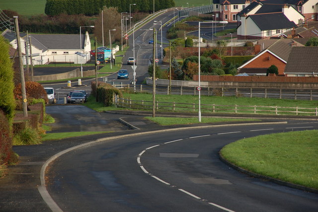
Image: © Albert Bridge Taken: 14 Nov 2006
The Rawbrae Road runs, in a reasonably straight line, from the Carrickfergus-Larne Road beyond Kilroot. It emerges, via a steep curve, back on to the same road at Bentra, near Whitehead. This is the view towards Whitehead at the staggered cross roads with the Slaughterford Road. The old alignment can be seen on the middle left of the photo.
Images are licensed for reuse under creativecommons.org/licenses/by-sa/2.0
Image Location
Latitude
54.757379
Longitude
-5.721651